NW N NE
W Go E
SW S SE

Grid reference SH4275

near to Mona, Isle of Anglesey/Sir Ynys Mon, Wales


Maps

1:50,000 Modern Day Landranger(TM) Map © Crown Copyright
TIP: Click the map for more Large scale mapping
Clickable map
+
Tip: Click the map to open the coverage map

Images in SH4275 Breakdown list images taken from SH4275
We have just one image taken from SH4275 of other squares
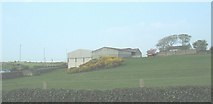
SH4175 : Cae Eithin Farm from the Heneglwys road by Eric Jones SH4175 : Cae Eithin Farm from the Heneglwys road
Cae Eithin means "whin/furze/gorse field".

 
| View these photos on a map | Find all images taken from this square |
   |   
Background Colour: White / /

You are not logged in login | register