Grid reference SH4275
near to Mona, Isle of Anglesey/Sir Ynys Mon, Wales
Coverage
We have
11 images
in grid square SH4275
Contribute
Explore gridsquare SH4275
Surrounding area
Maps
 Map © Crown Copyright")
TIP: Click the map for more Large scale mapping
Tip: Click the map to open the coverage map
We have
11 images
for SH4275
|
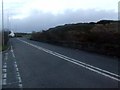
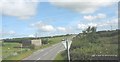
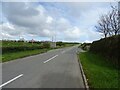
Road junction near Mona
The Bodffordd junction on the A5 road
|
|
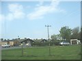
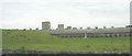
Hen houses at Heneglwys
by Eric Jones
The "hen" in Heneglwys has nothing to do with fowls. "Hen" is the Welsh word for "old/aged/ancient"
|
|
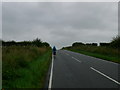
Lonely road
by Eirian Evans
The road to Bodffordd from the A5
|
|
Road towards Bodffordd
by Steven Brown
|
|
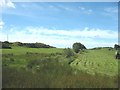
Cutting hay on a small meadow in area of small hills and rock outcrops
by Eric Jones
|
|
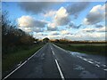
Road connecting the A5 with Heneglwys and Bodffordd
by Eric Jones
|
|
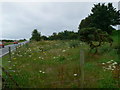
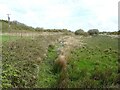
Set aside
by Eirian Evans
Fenced off wild garden off the Bodffordd road.
|
|
Poultry sheds at Heneglwys
by Eric Jones
|
|
Minor road towards Bodffordd
by JThomas
|
|
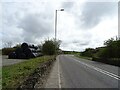
Ffordd Caergybi (Holyhead Road) heading east
by JThomas
|
|
Drain off the A5
by JThomas
|
|