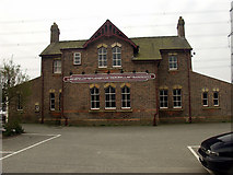
Grid reference SH5271
near to Llanfair Pwllgwyngyll, Isle of Anglesey/Sir Ynys Mon, Wales
Coverage
We have
285 images
in grid square SH5271
Contribute
Explore gridsquare SH5271
Surrounding area
We have
285 images
for SH5271
Because there are so many images for this square, please select a method to browse the images:
- View and explore other breakdowns in the Browser
- by Geographical Context
- by Automatic Cluster [82 Groups]
- by Contributor [69 Contributors]
- by Centisquare [29 Centisquares]
- by Category [40 Categories]
- by Month Taken [81 Months]
- by Year Taken [35 Years]
- by View Direction [17 Directions]
- by Camera Location [3 Gridsquares]
- by Camera Centisquare
- by Classification [2 Classifications]
- by Month Submitted [76 Months]
- by Year Submitted [20 Years]
- by Tags (inc surrounding squares)
- or Clustering Options:
· Automatic, Contributor, Date Taken or Year Taken

