Grid reference SH4673
near to Pentre Berw, Isle of Anglesey/Sir Ynys Mon, Wales
Coverage
We have
42 images
in grid square SH4673
Contribute
Explore gridsquare SH4673
Surrounding area
Maps
 Map © Crown Copyright")
TIP: Click the map for more Large scale mapping
Tip: Click the map to open the coverage map
Sample images
Breakdown list
images taken from SH4673 [4]
A sample of 12 photos from 42
for SH4673
- View this square in the Browser >>>
|
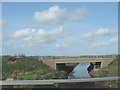
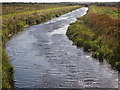
The A55 bridge over the canalised Afon Cefni
by Eric Jones
This image was taken from the A5.
|
|
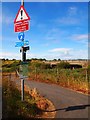
Lon Las Cefni at the A5
by Oliver Dixon
The Lon Las Cefni is a cycle track (part of National Cycle Network route 566) which follows the floodbank of the Afon Cefni. The crossing of the A5 is at grade.
|
|
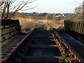
Railway lines on disused Bridge
Railway lines on disused bridge on the outskirts of Llangefni
|
|
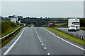
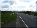
North Wales Expressway Westbound approaching Junction 6
by David Dixon
|
|
Ffordd Caergybi (Holyhead Road)
by JThomas
A5 towards Bangor.
|
|
Afon Cefni |
|
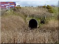
Culvert carrying the western drainage channel below the A5
by Eric Jones
|
|
Culvert under the A55
by Oliver Dixon
Carrying the South Drain which runs parallel to the Afon Cefni.
|
|
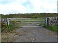
Field entrance off Ffordd Caergybi (Holyhead Road)
by JThomas
|
|
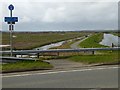
Lon Las Cefni
The cycleway that follows the Afon Cefni, at the point it crosses the A5 and passes under the A55 (visible in the background).
|
|
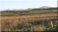
View across the Cefni Marshes towards the ruins of Llanfihangel Ysgeifiog Church
by Eric Jones
The Red Wharf-Pentre Berw railway ran along the eastern edge of the marshes.
|
|
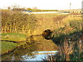
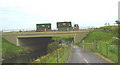
The cycleway (Lon Las Cefni) at Pont Berw
by Eric Jones
Pont Berw carries the A55 over Afon Cefni. The two unit lorry is carrying woodchip.
|
Explore more images in this square: | View Filtering options | View all 42 images page by page >>> |
|