2016
SH4673 : Lon Las Cefni at the A5
taken 8 years ago, near to Pentre Berw, Isle of Anglesey/Sir Ynys Mon, Wales
This is 1 of 2 images, with title starting with Lon Las Cefni at the in this square
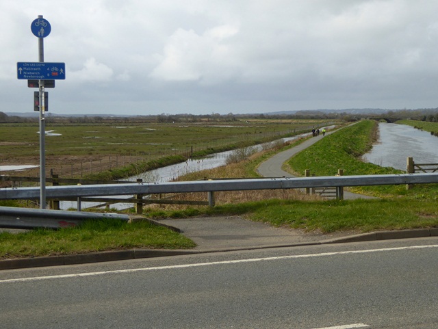
Lon Las Cefni at the A5
The Lon Las Cefni is a cycle track (part of National Cycle Network route 566) which follows the floodbank of the Afon Cefni. The crossing of the A5 is at grade.
 Map © Crown Copyright")
TIP: Click the map for more Large scale mapping
- Grid Square
- SH4673, 42 images (more nearby 🔍)
- Photographer
- Oliver Dixon (more nearby)
- Date Taken
- Friday, 8 April, 2016 (more nearby)
- Submitted
- Wednesday, 4 May, 2016
- Subject Location
-
OSGB36:
 SH 4614 7303 [10m precision]
WGS84: 53:13.9173N 4:18.3948W - Camera Location
-
OSGB36: SH 4617 7306
- View Direction
- Southwest (about 225 degrees)