Grid reference SH4672
near to Pentre Berw, Isle of Anglesey/Sir Ynys Mon, Wales
Coverage
We have
4 images
of other squares, taken from SH4672
Contribute
Explore gridsquare SH4672
Surrounding area
Maps
 Map © Crown Copyright")
TIP: Click the map for more Large scale mapping
Tip: Click the map to open the coverage map
We have
4 images
taken from SH4672 of other squares
|
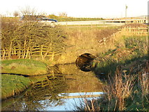
SH4673 : Culvert carrying the western drainage channel below the A5
by Eric Jones
|
|
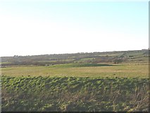
SH4573 : Mound in the reclaimed marshland west of the Cefni
by Eric Jones
This mound was probably the site of a now long disappeared church.
|
|
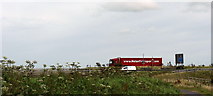
SH4673 : Hurrying to catch the afternoon ferry
by Eric Jones
|
|
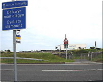
SH4673 : The A5 and A55 at the cycle path crossing
by Eric Jones
The A5 carries local traffic. The A55 Expressway provides a rapid connection between Holyhead, the British mainland and Europe. A considerable percentage of Ireland's exports and imports travels along this road.
|
|