Grid reference SH4374
near to Llangristiolus, Isle of Anglesey/Sir Ynys Mon, Wales
Coverage
We have
45 images
in grid square SH4374
Contribute
Explore gridsquare SH4374
Surrounding area
Maps
 Map © Crown Copyright")
TIP: Click the map for more Large scale mapping
Tip: Click the map to open the coverage map
Sample images
Breakdown list
A sample of 12 photos from 45
for SH4374
- View this square in the Browser >>>
|
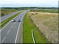
A55 trunk road looking east
Viewed from the B4422.
|
|
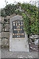
Old Milestone by the A5, Rhostrehwfa, Llangristiolus Parish
Telford Plate by the A5, in parish of Llangristiolus (Anglesey District), Rhostrehwfa.
Inscription reads:-
HOLY-
HEAD
14
MONA
1
BANGOR
11
Grade II listed by Cadw. Reference Number: 21077... (more)
|
|
North Wales Expressway, Westbound near to Llangristiolus
by David Dixon
|
|
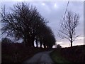
Dusk in the country lane
This is the lane behind the Tafarn y Rhos public house looking south
|
|
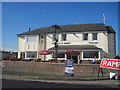
Tafarn-y-Rhos public House
by John Firth
At junction of A5 and B4422
|
|
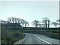
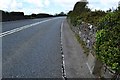
Bend in the A5 Holyhead Road near Rhostrehwfa
by Chris Gunns
|
|
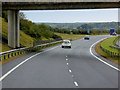
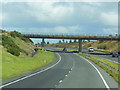
The A55 North Wales Expressway
by Ian S
At the B4422 road bridge.
|
|
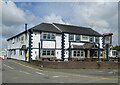
Tafarn Y Rhos
by JThomas
|
|
Cefncwmwd Summit
by Rude Health
Easy bag after finding the nearby hidden trig with Paul Webster.
Name: Cefncwmwd
Hill number: 14828
Height: 84m / 276ft
Parent (Ma/M): 1961 Mynydd Bodafon [Yr Arwydd]
Section: 30A: Anglesey and the Lleyn Peninsula
County/UA: Anglesey... (more)
|
|
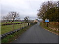
Lane near Ty Gwyn |
|
Holyhead 14
by Keith Evans
Milestone on the A.5 near to Llangristiolus, Isle of Anglesey for close up view see Link
|
|
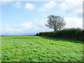
Field bounded by hedge
The field is on the south side of the A55, south of Rhostrehwfa. The dense hedge conceals an OS trig point, not visible in the image and hardly to be seen at all so thick is the hedge. The pillar has flush bracket No. S7320 and is close to... (more)
|
Explore more images in this square: | View Filtering options | View all 45 images page by page >>> |
|