Grid reference NY8181
near to Hesleyside, Northumberland, England
Coverage
We have
15 images
in grid square NY8181
Contribute
Explore gridsquare NY8181
Surrounding area
Maps
 Map © Crown Copyright")
TIP: Click the map for more Large scale mapping
Tip: Click the map to open the coverage map
We have
15 images
for NY8181
|
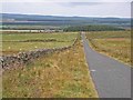
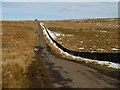
Road near Bellingham
by Oliver Dixon
This wonderful downhill swoop (for cyclists) is on the road from Bellingham to Wark Forest. The building to the left of the plantation is West Highridge.
|
|
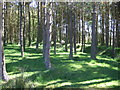
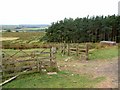
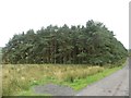
Woods at West Highridge
A couple of flossies hiding in the pine tree woods.
|
|
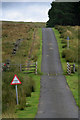
West Highridge
Road at West Highridge
|
|
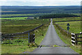
The road at West Highridge
by Barbara Carr
This stand of trees (mainly Scots pine) provide shelter for the sheep and cows which wander freely in this otherwise-exposed area of sparse grazing - beware black cattle if you travel this road on a dark night!
|
|
Rough grazing and plantation at West Highridge, Bellingham
by Oliver Dixon
|
|
Country road near Bellingham (2)
The road heads south-west between Ealinghamrigg and Shitlington Commons.
Wark Forest, part of Kielder Forest, sprawls across the rest of the scene.
|
|
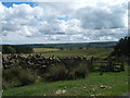
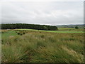
Northumbrian farmland
by Barbara Carr
Looking southward from the road near West Highridge. The rough grazing suits the sheep - some fields have been drained and are used for cattle-rearing.
|
|
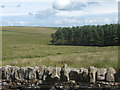
Grazing land, West Highridge
by Barbara Carr
Looking easterly across a very neat dry stone wall to the plantation surrounding East Highridge. The mast at the relay station on Ealingham Rigg SH8951 : Cae Gwyn can be seen in the background.
|

|
The road to Dunterley
by Barbara Carr
This road is part of National Cycleway 68 (the Pennine Cycleway) which runs from Derby to Norham and thence to Berwick-upon-Tweed.
|
|
Sheep grazing near West Highridge
A handful of sheep grazing the rough grassland to the north of West Highridge.
|
|
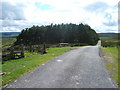
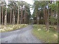
Roadside plantation at West Highridge
A large plantation beside the road close to the isolated buildings of West Highridge.
|
|
The road over Ealinghamrigg Common
by Oliver Dixon
Same road, opposite direction NY8181 : Road near Bellingham.
|
|
Near West Highridge
by T Eyre
Looking SE from the road.
|
|
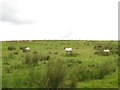
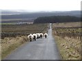
Local residents jay walking on the highway
by Russel Wills
As I approached some just climbed over the wall on the left!
West Highridge on the left.
|
|
Track to West Highridge
by Russel Wills
Public footpath to North Barneystead and Bridge House.
|
|