Grid reference NT8448
near to Swinton, Scottish Borders, Scotland
Coverage
We have
10 images
in grid square NT8448
Contribute
Explore gridsquare NT8448
Surrounding area
Maps
 Map © Crown Copyright")
TIP: Click the map for more Large scale mapping
Tip: Click the map to open the coverage map
We have
10 images
for NT8448
|
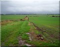
The Merse, Big fields.
by Richard Webb
Many fields have been amalgamated on arable farms to create larger fields more suited for mechanisation and continual arable use through artificial fertilizers. There are costs, to habitat loss and soil erosion.
|
|
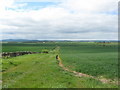
Field margin and crop
by James Denham
Near Swinton in Berwickshire.
|
|
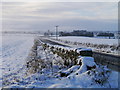
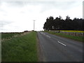
The B6461 In The Snow
A view of the B6461, east of Swinton Quarter, Berwickshire.
|
|
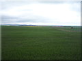
Crop field off the B6461
by JThomas
|
|
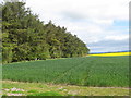
Shelter belt and crop
by James Denham
Near Swinton in Berwickshire.
|
|
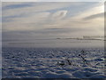
Swinton Snowscene
A view of farmland east of Swinton taken after the first significant snow fall at lower levels in December 2011.
|
|
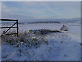
Field Boundary In Winter
A field boundary in arable farmland east of Swinton Quarter.
|
|
B6461 towards Berwick
by JThomas
Heading north east.
|
|
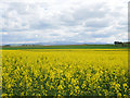
Fields of vibrant yellow, Swinton Quarter
Oil seed rape in The Merse, east of Swinton, with a view to the distant Cheviot Hills.
This photograph was taken during a 'socially-distanced' period of exercise from home during the Coronavirus (COVID-19) pandemic of 2020.
|
|
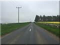
B6461 near Swinton
by Steven Brown
|
|