Grid reference NN5691
3 km from Crathie, Highland, Scotland
Coverage
We have
5 images
in grid square NN5691
Contribute
Explore gridsquare NN5691
Surrounding area
Maps
 Map © Crown Copyright")
TIP: Click the map for more Large scale mapping
Tip: Click the map to open the coverage map
We have
5 images
for NN5691
|
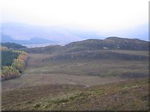
The real Creag Ruadh
The whole hill the photographer is standing on is generally called Creag Ruadh, but the name actually refers just to the crags the other side of the hillock pictured.
|
|
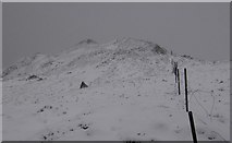
Creag Ruadh
An old fence leads up on to the summit shown on the map as Creag Ruadh.
|
|
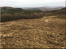
Boggy ground across to forestry near Creag Ruadh
by Steven Brown
|
|
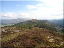
The summit of Creag Ruadh east top
This spot is often known as just Creag Ruadh, but hillwalkers now know this 558m point as the east top of Creag Ruadh itself, a 622m summit about 600 metres WNW (left) of here.
Looking north-east to the 564m hill Black Craig, the highest... (more)
|
|
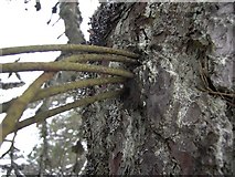
Wired
A fencer has left a roll of fence wire over the branch of a tree and forgotten about it, and over the years the tree has grown around the wire to encircle it.
|
|