2017
SH4175 : North Wales WWII defences: RAF Mona, Anglesey - LAA Emplacement & Blast Shelter (4)
taken 7 years ago, near to Heneglwys, Isle of Anglesey/Sir Ynys Mon, Wales
This is 1 of 4 images, with title starting with North Wales WWII defences: RAF Mona, Anglesey - LAA Emplacement in this square
North Wales WWII defences: RAF Mona, Anglesey - LAA Emplacement & Blast Shelter (4)
-
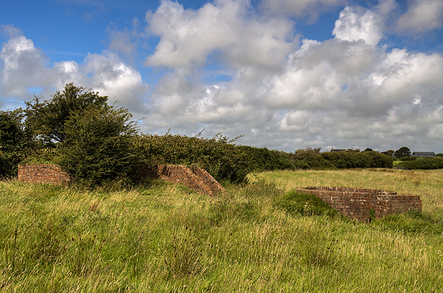
LAA Emplacement: DoB ID: e42025
Blast Shelter: DoB ID: e11033
The gun pit is situated just a few yards east of an open blast shelter, the latter being the sole survivor of 14 that once stood at various locations in and around the technical site. By late 1942 with the invasion threat from Germany having largely receded, the defences at new airfields such as Mona were accordingly downgraded. Open brick built blast shelters replaced the more substantial Stanton air raid shelters, and small open gun pits often provided the sole means of LAA defence.
SH4175 : North Wales WWII defences: RAF Mona, Anglesey - Blast Shelter (5)
 Map © Crown Copyright")
TIP: Click the map for more Large scale mapping
- Grid Square
- SH4175, 48 images (more nearby 🔍)
- Photographer
- Mike Searle (more nearby)
- Date Taken
- Monday, 31 July, 2017 (more nearby)
- Submitted
- Friday, 11 August, 2017
- Subject Location
-
OSGB36:
 SH 4106 7586 [10m precision]
WGS84: 53:15.3525N 4:23.0418W - Camera Location
-
OSGB36: SH 4105 7584
- View Direction
- North-northeast (about 22 degrees)