2009
NT1783 : Braefoot Point
taken 15 years ago, near to Dalgety Bay, Fife, Scotland
This is 1 of 2 images, with title Braefoot Point in this square
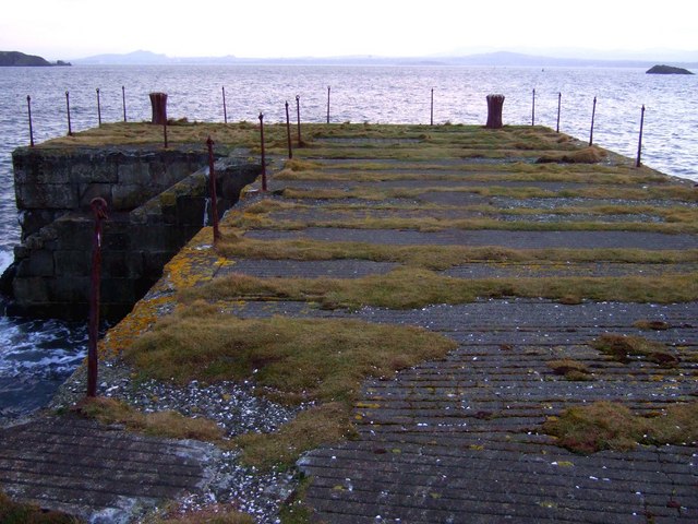
Braefoot Point
Disused Second World War stone pier. The Haystack on the right and Inchcolm on the left. Edinburgh skyline on the far coast.
 Map © Crown Copyright")
TIP: Click the map for more Large scale mapping
- Grid Square
- NT1783, 36 images (more nearby 🔍)
- Photographer
- Simon Johnston (more nearby)
- Date Taken
- Saturday, 31 January, 2009 (more nearby)
- Submitted
- Sunday, 21 June, 2009
- Subject Location
-
OSGB36:
 NT 176 830 [100m precision]
WGS84: 56:2.0048N 3:19.3967W - Camera Location
-
OSGB36: NT 176 831
- View Direction
- South-southeast (about 157 degrees)