Grid reference SH5171
near to Llanfair Pwllgwyngyll, Isle of Anglesey/Sir Ynys Mon, Wales
Coverage
We have
2 images
of other squares, taken from SH5171
Contribute
Explore gridsquare SH5171
Surrounding area
Maps
 Map © Crown Copyright")
TIP: Click the map for more Large scale mapping
Tip: Click the map to open the coverage map
We have
2 images
taken from SH5171 of other squares
|
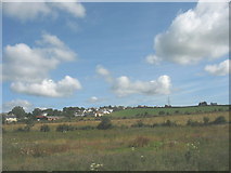
SH5172 : The village of Star from the A5
by Eric Jones
|
|
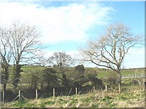
SH5172 : View across the A55 (hidden) and fields towards the village of Star
by Eric Jones
The A55 here runs through a cutting
|
|