Grid reference SH4872
near to Gaerwen, Isle of Anglesey/Sir Ynys Mon, Wales
Coverage
We have
12 images
in grid square SH4872
Contribute
Explore gridsquare SH4872
Surrounding area
Maps
 Map © Crown Copyright")
TIP: Click the map for more Large scale mapping
Tip: Click the map to open the coverage map
We have
12 images
for SH4872
|
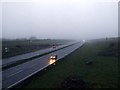
Gaerwen interchange on A55
Looking West from above the A55 road at the Gaerwen interchange, on a damp and misty February evening
|
|
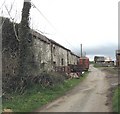
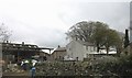
Old farm buildings at Cefn-du Farm
by Eric Jones
|
|
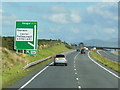
The A55 North Wales Expressway
by Ian S
Eastbound at Junction 7.
|
|
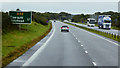
North Wales Expressway towards Holyhead
by David Dixon
|
|
Cefn-du Farmhouse
by Eric Jones
|
|
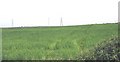
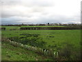
View north towards the pylons across cultivated grassland
by Eric Jones
|
|
View across cultivated grassland towards an area of rock outcrops and scrub
by Eric Jones
|
|
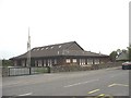
Capel y Mormoniaid Gaerwen Mormon Chapel
by Eric Jones
This modern style chapel dates back to 1985. In the early days of Mormonism, Wales had a number of congregations. Many of the pioneer Mormons migrated to Utah. In fact, today, in the state of Utah, half a million people, a fifth of the... (more)
|
|
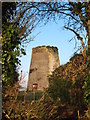
Melin Maengwyn |
|
Country west of Llanfairpwllgwyngyll
Seen from a lay-by on the westbound A55.
|
|
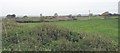
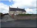
Houses, Gaerwen
by JThomas
|
|
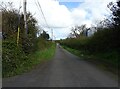
Dead end road, Gaerwen
by JThomas
Now bisected by the A55.
|
|