Grid reference SH4474
near to Llangristiolus, Isle of Anglesey/Sir Ynys Mon, Wales
Coverage
We have
20 images
in grid square SH4474
Contribute
Explore gridsquare SH4474
Surrounding area
Maps
 Map © Crown Copyright")
TIP: Click the map for more Large scale mapping
Tip: Click the map to open the coverage map
Sample images
Breakdown list
A sample of 12 photos from 20
for SH4474
- View this square in the Browser >>>
|
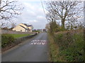
Minor road approaching the A5 |
|
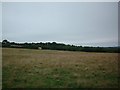
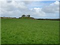
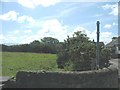
Pasture land
This image was taken from SH4449474434 looking NNE across the field. There was no livestock in the field, but I assume it to be used as pasture.
|
|
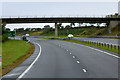
Waen-hir Bridge over the North Wales Expressway
by David Dixon
|
|
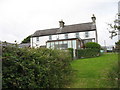
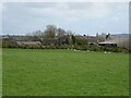
Ty'n Mur - a former smallholding
by Eric Jones
|
|
Grazing off the A5
by JThomas
|
|
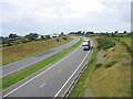
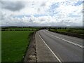
View west along the A55 from the Waen-hir bridge
by Eric Jones
|
|
Grazing towards Nant Newydd
by JThomas
|
|
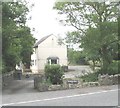
Ystumwerddon alongside the A5
by Eric Jones
A house well-guarded by a vocal resident hound.
|
|
Farmland and lane used as a public footpath at Rhostrehwfa
by Eric Jones
|
|
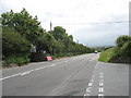
Ffordd Caergybi (Holyhead Road)
by JThomas
|
|
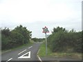
Minor junction on the A5
by Eric Jones
The main road leads to London while the single lane road to the right leads to Paradise SH4271.
|
|
Minor road leading northwards from the B 4422
by Eric Jones
|
Explore more images in this square: | View Filtering options | View all 20 images page by page >>> |
|