Grid reference SH4354
near to Pontllyfni, Gwynedd, Wales
Coverage
We have
9 images
in grid square SH4354
Contribute
Explore gridsquare SH4354
Surrounding area
Maps
 Map © Crown Copyright")
TIP: Click the map for more Large scale mapping
Tip: Click the map to open the coverage map
We have
9 images
for SH4354
|
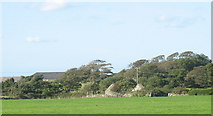
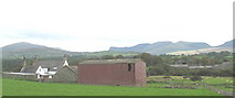
Looking Across the Fields Towards Ty Mawr Farm
by Eric Jones
|
|
Seaside footpath
by Eirian Evans
A faint path along the bank which protects the farmland from the inundation
|
|
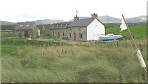
Ynys Fach
by Eric Jones
A former farmhouse which has been converted into a luxury residence by a boating enthusiast. The house is protected from the sea by an artificially raised shingle bar. An attempt has been made to stabilize the sand dunes behind the bar by... (more)
|
|
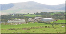
Fferm Cae-loda
by Eric Jones
|
|
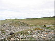
A Breach in the Pebble Bar
by Eric Jones
Here, where the bar is much narrower, the sea has managed to breach it in a couple of places, and it is obvious where waves have carried debris into the low lying land beyond.
|
|
Ynys and Ty Mawr Farms
by Eric Jones
|
|
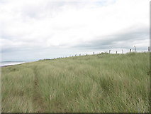
Marram Protected Dunes
by Eric Jones
For a stretch north of the Llifon estuary, the nature of the beach changes from pebbles to sand and the beach head is made up of dunes formed of blown sand. To protect these from erosion marram grass has been planted.
|
|
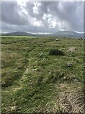
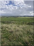
View inland across marshland
by Eirian Evans
The distant farm is Caerloda. Eryri mountains in the far distance shrouded in mist
|
|
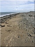
Shingle beach, Caernarfon Bay
by Eirian Evans
Dinas Dinlle in the distance
|
|