Grid reference SH3185
near to Llanfaethlu, Isle of Anglesey/Sir Ynys Mon, Wales
Coverage
We have
6 images
in grid square SH3185
Contribute
Explore gridsquare SH3185
Surrounding area
Maps
 Map © Crown Copyright")
TIP: Click the map for more Large scale mapping
Tip: Click the map to open the coverage map
We have
6 images
for SH3185
|
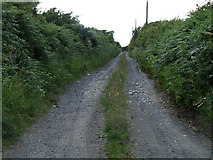
Track leading to Bodfardden ddu
A view from the A5025 road, looking up the lane that leads to Bodfardden ddu
|
|
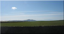
Pasture land north of Plas Newydd
by Eric Jones
Mynydd Twr/Holyhead Mountains can be seen in the background.
|
|
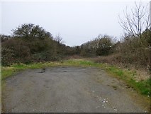
Plot of land at Plas Newydd
Land to the south of new housing on the A5025. A sign on the main road warns against fly tipping SH3185 : Dim Sbwriel / No Dumping.
|
|
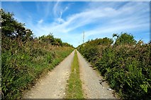
Track to Bodfardden-ddu
by Jeff Buck
Track heading west to Bodfardden-ddu from the A5025.
|

|
Drumlin west of Bodfardden-ddu
by Eric Jones
Bodfardden-ddu farmhouse can be seen at the extreme left of the image.
|
|
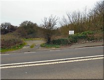
Dim Sbwriel / No Dumping
Looking across the A5025 to a plot of land not yet developed for housing SH3185 : Plot of land at Plas Newydd. A notice reads:
DIM SBWRIEL / NO DUMPING
|
|