Grid reference SD3722
near to Banks, Lancashire, England
Coverage
We have
3 images
in grid square SD3722
Contribute
Explore gridsquare SD3722
Surrounding area
Maps
 Map © Crown Copyright")
TIP: Click the map for more Large scale mapping
Tip: Click the map to open the coverage map
We have
3 images
for SD3722
|
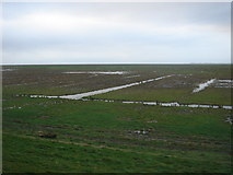
The edge of the Ribble estuary, near Banks
I was standing on top of a dyke that has been built to reclaim the fields that were behind it, looking towards the river and the sea in the distance.
|
|
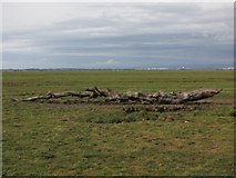
I wonder where this came from?
by K A
A washed up dead tree on Banks Marsh, it will probably move when the tide is large enough to lift it. The white buildings in the distance are the BAe Systems Warton Factory. Behind them to the right are the hills of Bowland Forest
|
|
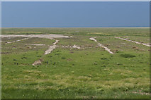
The view over Stone Gutter
by Ian Greig
The distant gate in the middle of this shot is unique to this view
|
|