Grid reference NY8179
4 km NNE of Stonehaugh, Northumberland, England
Coverage
We have
20 images
in grid square NY8179
Contribute
Explore gridsquare NY8179
Surrounding area
Maps
 Map © Crown Copyright")
TIP: Click the map for more Large scale mapping
Tip: Click the map to open the coverage map
A sample of 12 photos from 20
for NY8179
- View this square in the Browser >>>
|
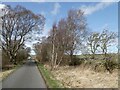
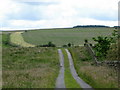
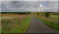
Pennine Cycleway by Shitlington Cross
by Oliver Dixon
The van is parked at the entrance to the driveway to Watergate Farm.
|
|
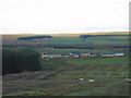
Watergate Farm, near Wark
by Les Hull
On the edge of Wark Forest.
|
|
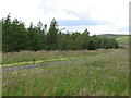
Leek Hill south of Hindrigg |
|
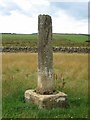
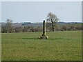
Old Wayside Cross, Helmsleyside, Wark Parish
Shitlington Cross, old shaft and base, by the path off UC road, in parish of Wark (Tynedale District), Helmsleyside, in field 20m from road.
Grade II Listed. List Entry Number: 1370440... (more)
|
|
The track to Watergate Farm
by Mike Quinn
|
|
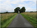
Road by the cross
by T Eyre
Looking NW.
|
|
Bridleway near Watergate
by Les Hull
|
|
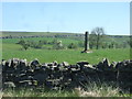
Ancient cross in a field
I have no idea what this cross did in the olden days. Shitlington Crags and Ealingham relay station in the far distance.
|
|
Watergate
Road near Watergate Farm.
|
|
Shitlington Cross
by Oliver Dixon
A wayside cross, thought to be of 13th century date, grade 2 listed.
|
|
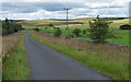
Minor road and plantation west of Bridge House
by Mike Quinn
The plantation is not marked on either LR87 or OL43. The sharp left hand bend in the road at around NY815802 can just be seen on the extreme right of the photo.
|
|
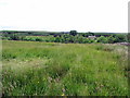
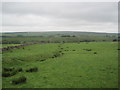
Country road near Wark (3)
Heading away from Wark, north-west towards moorland, including, in the distance, Shitlington Common.
|
Explore more images in this square: | View Filtering options | View all 20 images page by page >>> |
|