NJ8250 : Dalgarno's Croft
taken 18 days ago, near to Balthangie, Aberdeenshire, Scotland
This is 1 of 3 images, with title Dalgarno's Croft in this square
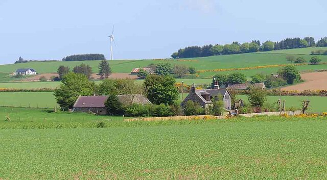
Dalgarno's Croft
This is slightly deceptive because the minor road passes between the foreground field and the croft. It is named on the 19th century maps as Berryhill, but on more recent maps it is named as Dalgarno's Croft, that originally being the name of a now vanished croft nearby NJ8250 : Tree Clump. That must avoid confusion with another Berryhill which is just a couple of miles south of Cuminestown. The distant white house is at Balthangie.
 Map © Crown Copyright")
TIP: Click the map for more Large scale mapping
- Grid Square
- NJ8250, 13 images (more nearby 🔍)
- Photographer
- Anne Burgess (more nearby)
- Date Taken
- Wednesday, 15 May, 2024 (more nearby)
- Submitted
- Friday, 17 May, 2024
- Subject Location
-
OSGB36:
 NJ 8284 5065 [10m precision]
WGS84: 57:32.7384N 2:17.3002W - Camera Location
-
OSGB36: NJ 8249 5049
- View Direction
- East-northeast (about 67 degrees)