NN0495 : The summit of Mam an Doire Dhuinn
taken 24 days ago, 4 km NE of Murlaggan, Highland, Scotland
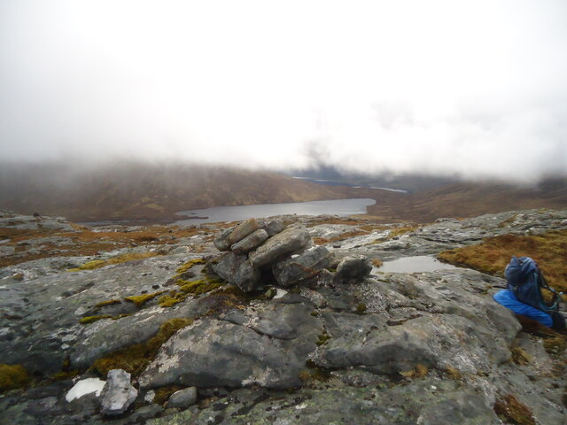
The summit of Mam an Doire Dhuinn
Looking south-east towards Loch Blair (that man gets everywhere!) and, in the distance, part of Loch Arkaig.
Michael Earnshaw, the photographer, knew that this day had the poorest forecast during his trip, so chose a short walk to a fairly low (564m) hill. This was clearly a success as he stayed beneath the clouds.
Mam an Doire Dhuinn is a Dodd. I won't attempt to define that - but as I compiled one of the lists (the 'Donald Deweys') which combined to form the Dodds, I could not refrain from advising you of this fact. If you are really interested, search for 'Database of British and Irish Hills'.
 Map © Crown Copyright")
TIP: Click the map for more Large scale mapping
- Grid Square
- NN0495, 9 images (more nearby 🔍)
- Photographer
- Michael Earnshaw (more nearby)
- Contributed by
- David Purchase (more nearby)
- Date Taken
- Thursday, 9 May, 2024 (more nearby)
- Submitted
- Monday, 13 May, 2024
- Subject Location
-
OSGB36:
 NN 0443 9545 [10m precision]
WGS84: 57:0.5183N 5:13.3405W - Camera Location
-
OSGB36: NN 0437 9550
- View Direction
- Southeast (about 135 degrees)