SW7343 : Old Boundary Marker in the Poldice Valley
taken 30 days ago, near to Scorrier, Cornwall, England
This is 1 of 9 images, with title Old Boundary Marker in the Poldice Valley in this square
Old Boundary Marker in the Poldice Valley
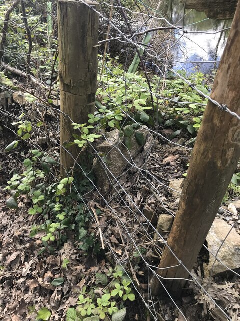
Mine Boundary Marker beside a track inside a mining area in the Poldice Valley. On the current boundary between Gwennap and Chacewater parishes. Inscribed 49. This stone not only defines the parish boundary but the mineral rights of local landowners.
Milestone Society National ID: CW_GWECHA49em
Milestone Society National ID: CW_GWECHA49em
National Survey of Wayside Features by The Milestone Society
These images are from Link
 Map © Crown Copyright")
TIP: Click the map for more Large scale mapping
- Grid Square
- SW7343, 78 images (more nearby 🔍)
- Photographer
- P Barnett (more nearby)
- Contributed by
- Milestone Society (more nearby)
- Date Taken
- Friday, 3 May, 2024 (more nearby)
- Submitted
- Monday, 13 May, 2024
- Subject Location
-
OSGB36:
 SW 73278 43538 [1m precision]
WGS84: 50:14.8939N 5:10.8900W - Camera Location
-
OSGB36: SW 73278 43538