SO2610 : Cefn y Galchen - Auxiliary Unit Operational Base (1)
taken 2 months ago, near to Blaenavon, Torfaen/Tor-Faen, Wales
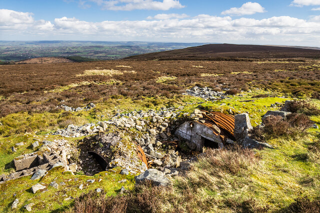
Cefn y Galchen - Auxiliary Unit Operational Base (1)
-
Auxiliary Unit Operational Base: DoB ID e44892
To the north of Blaenavon, at a remote site far from habitation, and close to the start of the walk to the summit of The Blorenge, are the remains of a secret WWII subterranean structure. In the event that Britain was invaded, it would have accommodated a small covert stay-behind force of men, along with their weapons and explosives. A desperate measure of last resort, recruitment came from able volunteer members of the Home Guard having good local knowledge, such as gamekeepers and farm workers. With a probable life expectancy of two weeks, they would have acted independently conducting sabotage and other nefarious activities against the enemy. Several hundred OBs were known to have been constructed from 1940 onwards throughout England, Wales, and Scotland. An overview of the auxiliary units: Link
SO2610 : Cefn y Galchen - Auxiliary Unit Operational Base (2)
 Map © Crown Copyright")
TIP: Click the map for more Large scale mapping
- Grid Square
- SO2610, 36 images (more nearby 🔍)
- Photographer
- Mike Searle (more nearby)
- Date Taken
- Sunday, 24 March, 2024 (more nearby)
- Submitted
- Sunday, 31 March, 2024
- Subject Location
-
OSGB36:
 SO 2634 1084 [10m precision]
WGS84: 51:47.4806N 3:4.1639W - Camera Location
-
OSGB36: SO 2632 1085
- View Direction
- East-southeast (about 112 degrees)