SO1040 : Cefn-Gafros Common
taken 3 months ago, near to Crickadarn, Powys, Wales
This is 1 of 3 images, with title Cefn-Gafros Common in this square
Cefn-Gafros Common
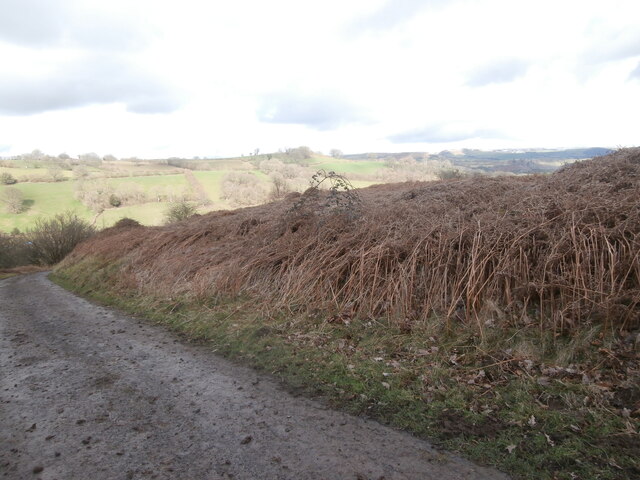
Looking round the other side of the bend seen in SO1040 : Cefn-Gafros Common, but on a muddy March day. Snow (which had fallen the previous day) is just visible on the hills away to the east. This road (if it can be called that) skirts and (after forking) crosses the steeply sloping access land on the slopes of Mynydd Fforest.
 Map © Crown Copyright")
TIP: Click the map for more Large scale mapping
- Grid Square
- SO1040, 7 images (more nearby 🔍)
- Photographer
- HelenK (more nearby)
- Date Taken
- Sunday, 3 March, 2024 (more nearby)
- Submitted
- Wednesday, 20 March, 2024
- Subject Location
-
OSGB36:
 SO 102 407 [100m precision]
WGS84: 52:3.4484N 3:18.6430W - Camera Location
-
OSGB36: SO 101 406
- View Direction
- North-northeast (about 22 degrees)