NT2982 : The island of Inchkeith
taken 3 months ago, 4 km SE of Pettycur, Fife, Scotland
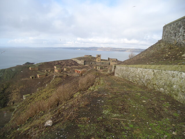
The island of Inchkeith
Apart from the Isle of May, Inchkeith is the largest (about 1.1 km long) and most easterly of the islands in the Firth of Forth. And like most such islands, it played a significant role in the defence of the firth in both World Wars, evidence of which can be seen in this photo. It was taken from near the highest point on the island (occupied by a lighthouse), and is looking NNW towards the Fife coast. Burntisland and Kinghorn can be seen.
 Map © Crown Copyright")
TIP: Click the map for more Large scale mapping
- Grid Square
- NT2982, 63 images (more nearby 🔍)
- Photographer
- Michael Earnshaw (more nearby)
- Contributed by
- David Purchase (more nearby)
- Date Taken
- Saturday, 2 March, 2024 (more nearby)
- Submitted
- Thursday, 14 March, 2024
- Subject Location
-
OSGB36:
 NT 2925 8297 [10m precision]
WGS84: 56:2.0623N 3:8.2189W - Camera Location
-
OSGB36: NT 2930 8284
- View Direction
- North-northwest (about 337 degrees)