TF0662 : St Peter's church, Dunston
taken 3 months ago, near to Dunston, Lincolnshire, England
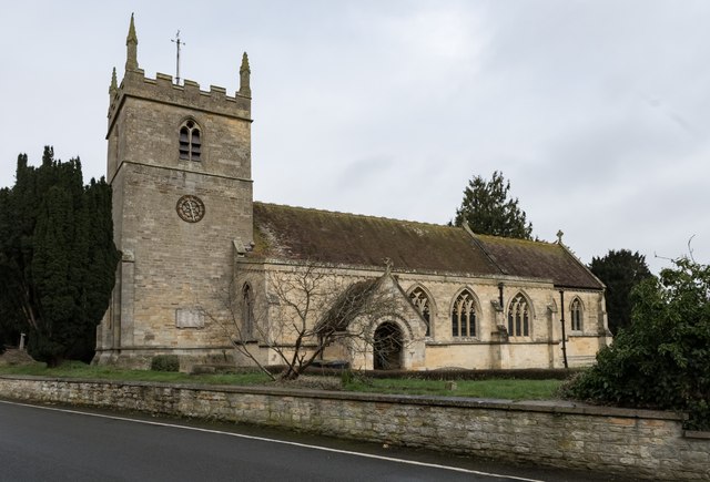
Grade II listed.
There was a church at Dunston recorded in the Doomsday Book, probably on the same site as the present church.
The old church was destroyed by fire with only the 12th century tower remaining intact.
There were originally 3 bells in the tower, and two more were added at a later date.
It was restored in 1874 and completed in 1875. The cost was £4700, most of which was given by the Marquis of Rippon. The architect was R. H. Carpenter of London, the builders were a local firm, Halkes and Son. During the rebuilding a north aisle was also added.
The north arcade is of four bays, the chancel is entirely the work of Carpenter and has a piscina, sedilia, aumbry and reredos behind the altar. The east window is a memorial to the Robinson family.
There is a hagioscope or squint, between the north aisle and the chancel
At the east end of the north aisle is an old Easter sepulchre, presumably retained from the old church.
The porch was rebuilt in 1772, the south doorway is Early English. The lock and key are original.
There is a marble font standing on a stone dais with a wooden cover.
There is a 2 manual pipe organ by Nicholson on the north side of the chancel.
 Map © Crown Copyright")
- Grid Square
- TF0662, 35 images (more nearby 🔍)
- Photographer
- Julian P Guffogg (more nearby)
- Date Taken
- Saturday, 17 February, 2024 (more nearby)
- Submitted
- Sunday, 18 February, 2024
- Subject Location
-
OSGB36:
 TF 0628 6294 [10m precision]
WGS84: 53:9.1800N 0:24.7297W - Camera Location
-
OSGB36: TF 0627 6292
- View Direction
- North-northeast (about 22 degrees)