2023
SH5071 : Ruined Toll House, A5, Llanfairpwllgwyngyll
taken 1 year ago, near to Llanddaniel Fab, Isle of Anglesey/Sir Ynys Mon, Wales
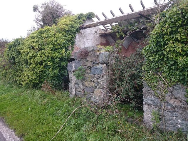
Ruined Toll House, A5, Llanfairpwllgwyngyll
Called Garnedd-ddu TP (black cairn) on 1900 maps, this served the Shrewsbury to Holyhead Turnpike Trust.
Probably added in the 19thC as an anti-avoidance measure to combat those who went round the back of the Llanfairpwll tollhouse (via Pont Ronwy). An alternative view is SH5071 : Ruined Cottage on the A5 Near Star.
Milestone Society National ID: ANG.GAD
Probably added in the 19thC as an anti-avoidance measure to combat those who went round the back of the Llanfairpwll tollhouse (via Pont Ronwy). An alternative view is SH5071 : Ruined Cottage on the A5 Near Star.
Milestone Society National ID: ANG.GAD
National Survey of Wayside Features by The Milestone Society
These images are from Link
 Map © Crown Copyright")
TIP: Click the map for more Large scale mapping
- Grid Square
- SH5071, 26 images (more nearby 🔍)
- Photographer
- David Elis-Williams (more nearby)
- Contributed by
- Mr Red (more nearby)
- Date Taken
- Friday, 10 March, 2023 (more nearby)
- Submitted
- Friday, 10 March, 2023
- Subject Location
-
OSGB36:
 SH 50758 71958 [1m precision]
WGS84: 53:13.4187N 4:14.2170W - Camera Location
-
OSGB36: SH 50758 71958
- View Direction
- North-northwest (about 337 degrees)