2022
SU2567 : The A4 approaches Savernake
taken 2 years ago, 3 km from Chisbury, Wiltshire, England
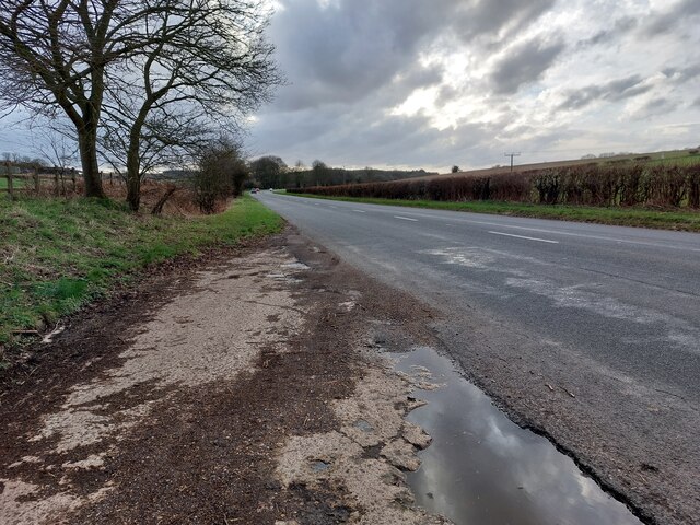
The A4 approaches Savernake
Almost identical view to SU2567 : The Road to Bath and a similar time of year. This little layby would appear to have had little upkeep in the 16 years that separate the two, to judge by the road surface. Knowle Farm, at the bend in the road ahead, marks the beginning of the Savernake Estate.
 Map © Crown Copyright")
TIP: Click the map for more Large scale mapping
- Grid Square
- SU2567, 69 images (more nearby 🔍)
- Photographer
- HelenK (more nearby)
- Date Taken
- Saturday, 12 March, 2022 (more nearby)
- Submitted
- Saturday, 12 March, 2022
- Subject Location
-
OSGB36:
 SU 2554 6770 [10m precision]
WGS84: 51:24.4653N 1:38.0517W - Camera Location
-
OSGB36: SU 2583 6783
- View Direction
- West-southwest (about 247 degrees)