2011
SH4274 : Old Milestone by the A5, Holyhead Road, Llangristiolus Parish
taken 13 years ago, near to Mona, Isle of Anglesey/Sir Ynys Mon, Wales
This is 1 of 2 images, with title Old Milestone by the A5, Holyhead Road, Llangristiolus Parish in this square
Old Milestone by the A5, Holyhead Road, Llangristiolus Parish
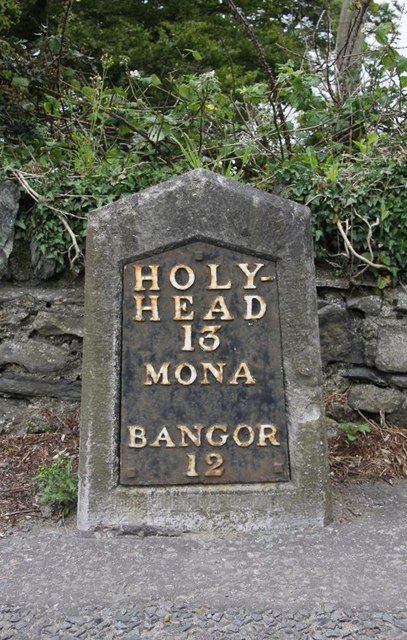
Telford Plate by the A5, in parish of Llangristiolus (Anglesey District), Cerrigceinwen, Mona, on East side of road, opposite Mona Isaf and Old Coach House.
Inscription reads:-
HOLY-
HEAD
13
MONA
BANGOR
12
Grade II listed by Cadw.
Reference Number 21076: Link
Surveyed
Milestone Society National ID: ANG_HH13
Inscription reads:-
HOLY-
HEAD
13
MONA
BANGOR
12
Grade II listed by Cadw.
Reference Number 21076: Link
Surveyed
Milestone Society National ID: ANG_HH13
National Survey of Wayside Features by The Milestone Society
These images are from Link
 Map © Crown Copyright")
TIP: Click the map for more Large scale mapping
- Grid Square
- SH4274, 15 images (more nearby 🔍)
- Photographer
- Milestone Society (more nearby)
- Date Taken
- 2011 (more nearby)
- Submitted
- Sunday, 3 February, 2019
- Subject Location
-
OSGB36:
 SH 42579 74966 [1m precision]
WGS84: 53:14.8979N 4:21.6503W - Camera Location
-
OSGB36: SH 42579 74966
- View Direction
- North-northeast (about 22 degrees)