2017
SH4075 : North Wales WWII defences: RAF Mona, Anglesey - LAA Emplacement (7)
taken 7 years ago, near to Heneglwys, Isle of Anglesey/Sir Ynys Mon, Wales
This is 1 of 3 images, with title starting with North Wales WWII defences: RAF Mona, Anglesey - LAA Emplacement in this square
North Wales WWII defences: RAF Mona, Anglesey - LAA Emplacement (7)
-
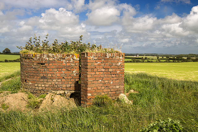
LAA Emplacement: DoB ID: e42026
The second of two surviving WWII circular brick-built LAA gun pits. This is similar to the one further east, although taller, with at least 15 brick courses visible above ground compared to the 10 of the first one.
SH4075 : North Wales WWII defences: RAF Mona, Anglesey - LAA Emplacement (8)
 Map © Crown Copyright")
TIP: Click the map for more Large scale mapping
- Grid Square
- SH4075, 37 images (more nearby 🔍)
- Photographer
- Mike Searle (more nearby)
- Date Taken
- Monday, 31 July, 2017 (more nearby)
- Submitted
- Friday, 11 August, 2017
- Subject Location
-
OSGB36:
 SH 4072 7587 [10m precision]
WGS84: 53:15.3517N 4:23.3476W - Camera Location
-
OSGB36: SH 4072 7586
- View Direction
- Northeast (about 45 degrees)