2016
SH3372 : Public footpath near Rhosneigr
taken 8 years ago, near to Llanfaelog, Isle of Anglesey/Sir Ynys Mon, Wales
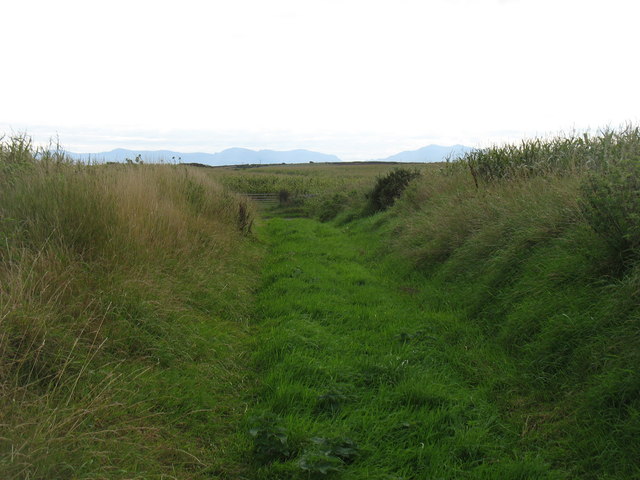
Public footpath near Rhosneigr
The Snowdonian hills are in the background. On the right are Crib y Ddysgl (1065m) and Snowdon (Yr Wyddfa) itself (1085m).
 Map © Crown Copyright")
TIP: Click the map for more Large scale mapping
- Grid Square
- SH3372, 42 images (more nearby 🔍)
- Photographer
- David Purchase (more nearby)
- Date Taken
- Tuesday, 20 September, 2016 (more nearby)
- Submitted
- Monday, 26 September, 2016
- Subject Location
-
OSGB36:
 SH 3323 7220 [10m precision]
WGS84: 53:13.2362N 4:29.9621W - Camera Location
-
OSGB36: SH 3318 7221
- View Direction
- East-southeast (about 112 degrees)