2016
SH4772 : Footpath at Pentre Berw
taken 8 years ago, near to Pentre Berw, Isle of Anglesey/Sir Ynys Mon, Wales
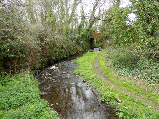
Footpath at Pentre Berw
The bridge carries the disused Gaerwen to Amlwch railway line.
 Map © Crown Copyright")
TIP: Click the map for more Large scale mapping
- Grid Square
- SH4772, 56 images (more nearby 🔍)
- Photographer
- Oliver Dixon (more nearby)
- Date Taken
- Friday, 8 April, 2016 (more nearby)
- Submitted
- Thursday, 5 May, 2016
- Subject Location
-
OSGB36:
 SH 4701 7239 [10m precision]
WGS84: 53:13.5875N 4:17.5950W - Camera Location
-
OSGB36: SH 4704 7238
- View Direction
- West-northwest (about 292 degrees)