2007
SH5471 : The Swelly Rock Marker
taken 17 years ago, near to Menai Bridge, Isle of Anglesey/Sir Ynys Mon, Wales
This is 1 of 2 images, with title starting with The Swelly Rock in this square
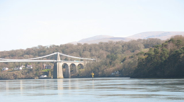
The Swelly Rock Marker
The Swellies - Pwll Ceris in Welsh - is the most treacherous section of the Menai Strait. A medieval document quoted in the fabulously illustrated book 'The Menai Strait' [2003] (also published in Welsh under the title 'Y Fenai'[2002]) by Gwyn Pari Huws and Terry Beggs (Gwasg Gomer Press) states
'In that arm of the sea that departeth between this island Mon and North Wales is a swelowe that draweth to schippes that seileth and sweloweth hem yn, as doth Scylla and Charybdis - therefore we may nouzt seile by this swalowe but slily at the full see'.
'In that arm of the sea that departeth between this island Mon and North Wales is a swelowe that draweth to schippes that seileth and sweloweth hem yn, as doth Scylla and Charybdis - therefore we may nouzt seile by this swalowe but slily at the full see'.
 Map © Crown Copyright")
TIP: Click the map for more Large scale mapping
- Grid Square
- SH5471, 279 images (more nearby 🔍)
- Photographer
- Eric Jones (more nearby)
- Date Taken
- Wednesday, 4 April, 2007 (more nearby)
- Submitted
- Sunday, 20 May, 2007
- Subject Location
-
OSGB36:
 SH 549 713 [100m precision]
WGS84: 53:13.1765N 4:10.4546W - Camera Location
-
OSGB36: SH 544 716
- View Direction
- East-southeast (about 112 degrees)