SH5271 : Llanfairpwllgwyngyllgogerychwyrndrobwllllantysiliogogogoch station
taken 10 years ago, near to Llanfair Pwllgwyngyll, Isle of Anglesey/Sir Ynys Mon, Wales
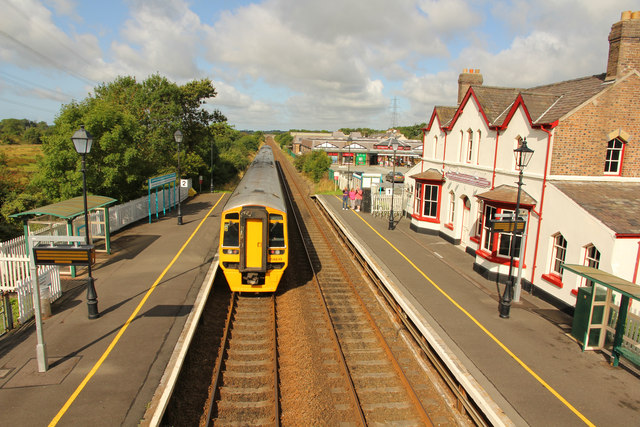
Llanfairpwllgwyngyllgogerychwyrndrobwllllantysiliogogogoch. This otherwise unremarkable village is known for its very long name which translates as St. Mary's Church in the hollow of the white hazel near the rapid whirlpool and the church of St. Tysilio with a red cave. The name is however an entirely artificial construct reputedly created in 1860 as a publicity stunt by a local businessman - although the exact story of its origin is obscure. If the intention was to put Llanfairpwllgwyngyll (the original name, still used by the Ordnance Survey) on the map, then it was spectacularly successful. No doubt because the railway decided to use the full name for its station, a tradition which continues to this day, the village attracts a steady stream of tourists happy to photograph the name board, and perhaps spend some money in the shops.
The station itself was closed in 1966 but reopened in 1970, initially as a temporary terminus while the Britannia Bridge was being repaired following fire damage.
 Map © Crown Copyright")
- Grid Square
- SH5271, 285 images (more nearby 🔍)
- Photographer
- Richard Croft (more nearby)
- Date Taken
- Sunday, 17 August, 2014 (more nearby)
- Submitted
- Monday, 25 August, 2014
- Subject Location
-
OSGB36:
 SH 5259 7159 [10m precision]
WGS84: 53:13.2511N 4:12.5616W - Camera Location
-
OSGB36: SH 5261 7158
- View Direction
- WEST (about 270 degrees)