2013
SH2781 : Penrhos Park Dairy
taken 11 years ago, near to Penrhos, Isle of Anglesey/Sir Ynys Mon, Wales
This is 1 of 4 images, with title starting with Penrhos Park in this square
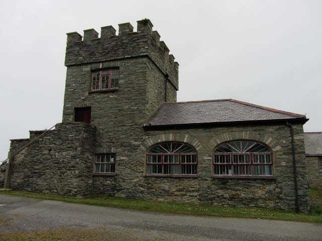
Penrhos Park Dairy
Part of the Penrhos Farm building range this was originally built as accommodation and later used as a dairy.
 Map © Crown Copyright")
TIP: Click the map for more Large scale mapping
- Grid Square
- SH2781, 58 images (more nearby 🔍)
- Photographer
- Paul Brooker (more nearby)
- Date Taken
- Saturday, 11 May, 2013 (more nearby)
- Submitted
- Wednesday, 22 May, 2013
- Subject Location
-
OSGB36:
 SH 2703 8145 [10m precision]
WGS84: 53:18.1009N 4:35.8297W - Camera Location
-
OSGB36: SH 2704 8144
- View Direction
- North-northwest (about 337 degrees)