2011
SJ7481 : Tatton Park tower
taken 13 years ago, near to Mere, Cheshire East, England
This is 1 of 27 images, with title starting with Tatton Park in this square
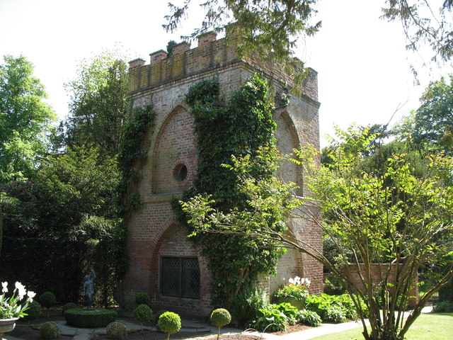
Tatton Park tower
This folly tower was used to watch over the estate for sheep rustlers and later a resident hermit used to "Frighten" the guests as they walked in the gardens.
 Map © Crown Copyright")
TIP: Click the map for more Large scale mapping
- Grid Square
- SJ7481, 239 images (more nearby 🔍)
- Photographer
- Paul Brooker (more nearby)
- Date Taken
- Wednesday, 4 May, 2011 (more nearby)
- Submitted
- Sunday, 8 May, 2011
- Subject Location
-
OSGB36:
 SJ 743 813 [100m precision]
WGS84: 53:19.6792N 2:23.2400W - Camera Location
-
OSGB36: SJ 743 813
- View Direction
- SOUTH (about 180 degrees)