2009
NY6989 : Lakeside Way - Kielder Water
taken 15 years ago, 4 km WNW of Falstone, Northumberland, England
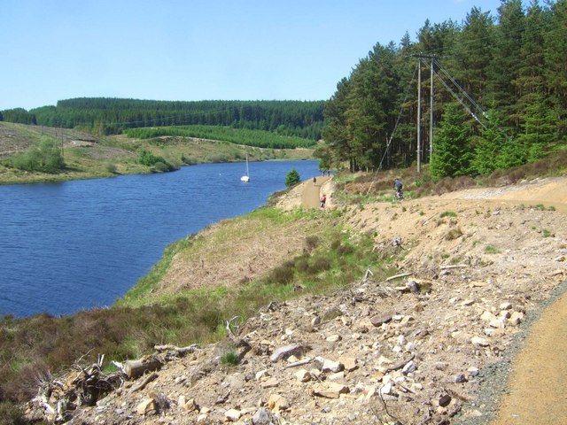
Lakeside Way - Kielder Water
The Lakeside Way was recently completed (2009) and is a full perimeter walking and cycling route hugging the lakeside of the UK's largest body of water. (42 Km).
 Map © Crown Copyright")
TIP: Click the map for more Large scale mapping
- Grid Square
- NY6989, 26 images (more nearby 🔍)
- Photographer
- Simon Johnston (more nearby)
- Date Taken
- Saturday, 30 May, 2009 (more nearby)
- Submitted
- Sunday, 21 June, 2009
- Subject Location
-
OSGB36:
 NY 691 891 [100m precision]
WGS84: 55:11.7226N 2:29.1882W - Camera Location
-
OSGB36: NY 691 890
- View Direction
- North-northwest (about 337 degrees)