2008
SH3975 : View uphill towards the crossroads at Upper Gwalchmai
taken 16 years ago, near to Gwalchmai, Isle of Anglesey/Sir Ynys Mon, Wales
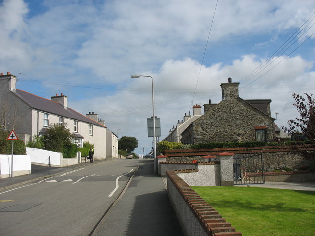
View uphill towards the crossroads at Upper Gwalchmai
The stone built cottage on the right- Yr Hen Ysgol - is the former village school.
 Map © Crown Copyright")
TIP: Click the map for more Large scale mapping
- Grid Square
- SH3975, 29 images (more nearby 🔍)
- Photographer
- Eric Jones (more nearby)
- Date Taken
- Saturday, 20 September, 2008 (more nearby)
- Submitted
- Monday, 20 October, 2008
- Subject Location
-
OSGB36:
 SH 391 757 [100m precision]
WGS84: 53:15.2310N 4:24.7891W - Camera Location
-
OSGB36: SH 390 756
- View Direction
- Northeast (about 45 degrees)