Grid reference TQ3182
near to Shoreditch, Islington, England
Coverage
We have
1,462 images
in grid square TQ3182
Contribute
Explore gridsquare TQ3182
Surrounding area
Maps
 Map © Crown Copyright")
TIP: Click the map for more Large scale mapping
Tip: Click the map to open the coverage map
A sample of 12 photos from 1,462
for TQ3182
- View this square in the Browser >>>
|
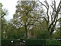
Myddelton Square, Clerkenwell
by Bikeboy
Showing the rear of St Mark's church with the trees coming into leaf
|
|
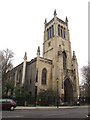
St Mark's, Clerkenwell: tower
The sturdy west tower is typical of its era (late Georgian / early neo-Gothic).
|
|
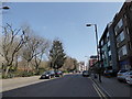
Geffrye meets his Waterloo (184)
by Basher Eyre
Looking east-northeast in Lever Street
|
|
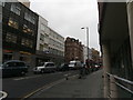
Clerkenwell Road, looking west from the Farringdon Road crossroads |
|
Fleet Valley from Lloyd Square
by Robin Hall
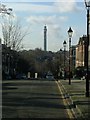
This view across the Fleet Valley is towards the Telecom Tower (No! Yes!) which is a mile or more away at this point.
This doesn't have the appearance of a valley that you would write songs about does it?
|
|
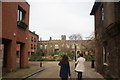
View of the infirmary in the Charterhouse #3
by Robert Lamb
Looking north-northwest.
|
|
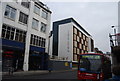
Derwent Point, Goswell Rd
by N Chadwick
|
|
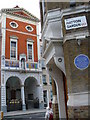
St Peter's Church
by Colin Smith
Italian church on Clerkenwell Road facing Hatton Garden (famed for its diamond merchants) and Sir Hiram Maxim's House. Maxim, of machine gun fame, was an engineer and inventor.
|
|
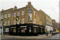
Filthy McNasty's
On Inglebert Road.
|
|
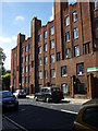
Charles Rowan House, Margery Street, Islington
by Jim Osley
Built 1928/1930, the original intention married quarters for police officers. For more visit Link
|
|
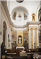
St Peter, Clerkenwell Road, Clerkenwell - Shine (set of 2 images)
by John Salmon
|
|
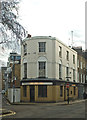
Former public house, Sekforde Street, Clerkenwell
by Jim Osley
Yet another closed public house, this Link shows it when in business.
|
Explore more images in this square: | View Filtering options | View upto 1000 images page by page >>> |
|