Grid reference SZ0797
near to West Parley, Dorset, England
Coverage
We have
30 images
in grid square SZ0797
Contribute
Explore gridsquare SZ0797
Surrounding area
Maps
 Map © Crown Copyright")
TIP: Click the map for more Large scale mapping
Tip: Click the map to open the coverage map
Sample images
Breakdown list
A sample of 12 photos from 30
for SZ0797
- View this square in the Browser >>>
|
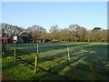
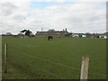
Grazing, West Parley
by JThomas
|
|
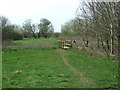
A bridge on the Ferndown, Stour & Forest Trail |
|
Residential area, North Bournemouth
This residential area is close to Kinson and is on the edge of the flood plain of the River Stour.
|
|
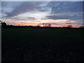
The northern fringe of Bournemouth
Looking across fields from the end of Castleton Avenue, between Kinson and Ensbury.
|
|
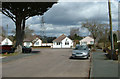
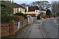
Houses on the bend just before Ensbury Bridge
by David Martin
|
|
Bournemouth : Field
by Lewis Clarke
|
|
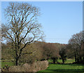
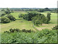
Stour Valley Path
by Mike Smith
This shows the line of the path west of Dudsbury Rings, heading towards Longham.
|
|
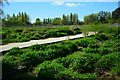
Dudsbury Ford
by John Walton
This irish bridge ford beside Dudsbury Golf Course is found on the Ferndown Stour and Forest Trail.
|
|
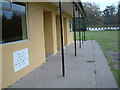
Guide Hut, Dudsbury, Dorset
Dudsbury Camp (Hillfort), an ancient site overlooking the Stour, from which the Ancient Britons guarded the ford across the river.
Although Dudsbury was named after a Saxon called Dude, it was first fortified by men 150BC.
|
|
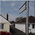
Kinson: Coppice Close
by Chris Downer
A recent infill of a few bungalows in the back gardens of Markham Avenue.
This is photo no.85 of a series of 453 in my coronavirus lockdown walking project:
See... (more)
|
|
Kinson Manor Farm
by Mike Faherty
Farm to the North of Kinson, on floodplain of the River Stour. The farmhouse (behind long barn to right) is English Heritage-listed.Link
|
|
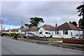
Bungalows on Markham Avenue
by Nigel Mykura
These suburban bungalows are on a quiet residential cul-de-sac on the very northern edge of the Bournemouth conurbation.
|
Explore more images in this square: | View Filtering options | View all 30 images page by page >>> |
|