Grid reference SZ0794
near to Ensbury, Bournemouth, Christchurch & Poole, England
Coverage
We have
297 images
in grid square SZ0794
Contribute
Explore gridsquare SZ0794
Surrounding area
Maps
 Map © Crown Copyright")
TIP: Click the map for more Large scale mapping
Tip: Click the map to open the coverage map
A sample of 12 photos from 297
for SZ0794
- View this square in the Browser >>>
|
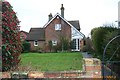
Lollipop Farmhouse (Talbot Village) - Columbia Road
by Bob Woods
Lollipop Farmhouse (now lollipop cottage) was one of the five farms of the original 'Talbot Village' The village built by two wealthy sisters following a unemployment relief scheme in the 1850's and originally consisted of... (more)
|
|
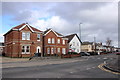
Houses on Columbia Rd
by Nigel Mykura
These detached red brick houses are on Columbia Rd close to the junction with Priestly Rd
|
|
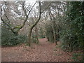
Talbot Village, footpath
by Mike Faherty
Footpath through mixed coniferous & broad-leaved woodland in the middle of Talbot Village; marked on old maps as heathland & gravel pits.
|

|
Ensbury Park: footpath N20 from Singleton Drive
by Chris Downer
A public footpath runs through to Slades Farm Road from midway along Singleton Drive, crossing the rear garage driveway on the way. See SZ0794 : Ensbury Park: footpath N20 crosses a driveway for the view along the more distant segment of the path.
|
|
Bournemouth : Victoria Park
by Lewis Clarke
Victoria Park is home of the Bournemouth Football Club. Before the Poppies moved here this was just a farmer's field.
|
|
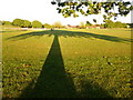
Ensbury Park: large trees shadow on Slades Farm
by Chris Downer
We stand under a large tree, at gone 8 o'clock on a beautiful day, as it casts a long shadow across the Slades Farm open space.
|
|
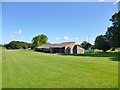
Ensbury Park, sport pavilion
by Mike Faherty
Aka changing room; at Slades Farm.
|
|
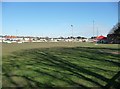
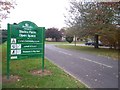
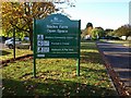
Bournemouth : Slades Farm Open Space
by Lewis Clarke
A sign welcoming visitors to Slades Farm - since this photo the graffiti has been removed.
|
|
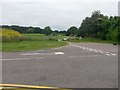
Ensbury Park: the end of Slades Farm Road and footpath N22
by Chris Downer
Slades Farm Road comes to an abrupt end, as if there was the expectation of further development at some future time, especially with the give way markings here at the end of Ensbury Avenue - there will surely never be anything to give way... (more)
|
|
Slades Farm Open Space
by Derek Harper
Proof, as if it were needed, that the graffiti has indeed been removed from SZ0794 : Bournemouth : Slades Farm Open Space. The adjoining car park on the left is for SZ0794 : Ensbury Park: Bournemouth Learning Centre.
|
|
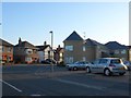
Ensbury Park
by Nigel Mykura
This is the junction of Howeth Rd , Columbia Rd and Glenville Avenue as viewed from Howeth Rd. The detached houses are on Columbia Rd the east-west route through Ensbury Park.
|
|
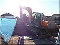
Bournemouth : Construction on Beswick Avenue
by Lewis Clarke
Don't know what they're building here - but it will probably be flats or something equally as dull.
|
Explore more images in this square: | View Filtering options | View all 297 images page by page >>> |
|