Grid reference SX0052
near to Trewoon, Cornwall, England
Coverage
We have
31 images
in grid square SX0052
Contribute
Explore gridsquare SX0052
Surrounding area
Maps
 Map © Crown Copyright")
TIP: Click the map for more Large scale mapping
Tip: Click the map to open the coverage map
Sample images
Breakdown list
images taken from SX0052 [2]
A sample of 12 photos from 31
for SX0052
- View this square in the Browser >>>
|
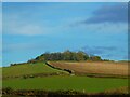
Hill's Quarry
Hill's Quarry in Cornwall, UK.
|
|
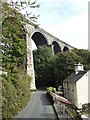
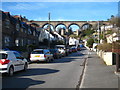
St Austell viaduct
The Penzance line crosses the Trenance valley to the west of St Austell town centre. It is 115 feet high, 720 feet long, and has 10 piers.
The original viaducts built by I K Brunel on this line were wooden viaducts built on top of stone... (more)
|
|
West Bridge over the River Vinnick
by John Lush
Erected prior to 1538
|
|
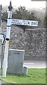
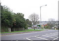
Fingerpost
by Paul Barnett
National ID
CW_SX0052
|
|
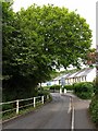
Gover Road, St Austell
by Tony Atkin
in the St Austell suburbs to the west of the town centre. Housing covers the valley floor and the south facing slopes but wisely the steep north facing slopes have been left to the trees.
|
|
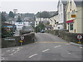
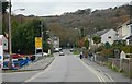
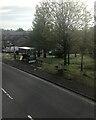
Junction between the A3058 and A390 west of St. Austell |
|
Gover Road, St Austell
by Derek Harper
Another view along SX0052 : The western end of Gover Road, looking up the valley of the Gover Stream, which runs beside the road.
|
|
Grove Road St Austell
by Rod Allday
Part of the housing development in the Gover Valley, which is spanned by the railway viaduct carrying the London - Penzance main line.
|
|
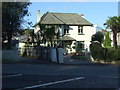
House on Penwinnick Road, St Austell
by JThomas
|
|
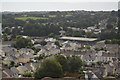
View from the Trenance Viaduct (set of 2 images)
by N Chadwick
|
|
Old Milestone by the A390, St Austell
by P Barnett
Carved stone post by the A390, in parish of ST AUSTELL (RESTORMEL District), Truro Road, opposite No. 22, on open grass, on South side of road. St Austell Roman stone, erected by the St Austell & Lostwithiel turnpike trust in the 18th... (more)
|
|
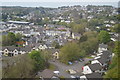
St Austell: roofscape
by N Chadwick
|
Explore more images in this square: | View Filtering options | View all 31 images page by page >>> |
|