Grid reference SE9700
near to Redbourne, North Lincolnshire, England
Coverage
We have
32 images
in grid square SE9700
Contribute
Explore gridsquare SE9700
Surrounding area
Maps
 Map © Crown Copyright")
TIP: Click the map for more Large scale mapping
Tip: Click the map to open the coverage map
A sample of 12 photos from 32
for SE9700
- View this square in the Browser >>>
|
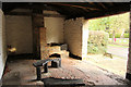
Redbourne Smithy (set of 2 images)
Inside Redbourne Smithy Link
|
|
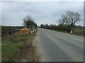
B1206 heading north
by JThomas
Towards Hibaldstow.
|
|
Carr Lane, Redbourne
by Glyn Drury
|
|
Down the red earth furrows to Redbourne
by Chris
|
|
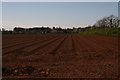
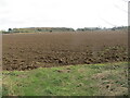
A recently ploughed field near to Redbourne
by Peter Wood
Looking south-eastward.
|
|
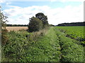
Path from Redbourne towards River Head
by David Brown
|
|
Path to Little Redbourne |
|
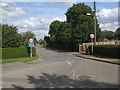
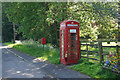
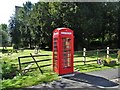
Telephone box on School Lane, Redbourne
by Ian S
|
|
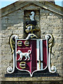
St.Albans Arms
Carved, painted arms of the Duke of St.Albans on St.Albans Cottages Link
|
|
The redundant telephone kiosk in Redbourne
by Neil Theasby
|
|
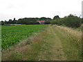
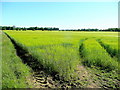
Ripening barley
Fields to the east of Redbourne.
|
|
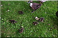
Ducklings in School Lane, Redbourne
by Chris
|
Explore more images in this square: | View Filtering options | View all 32 images page by page >>> |
|