Grid reference NY8177
3 km from Stonehaugh, Northumberland, England
Coverage
We have
22 images
in grid square NY8177
Contribute
Explore gridsquare NY8177
Surrounding area
Maps
 Map © Crown Copyright")
TIP: Click the map for more Large scale mapping
Tip: Click the map to open the coverage map
Sample images
Breakdown list
mentioning NY8177 [1]
A sample of 12 photos from 22
for NY8177
- View this square in the Browser >>>
|
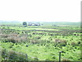
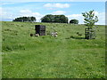
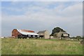
Horneystead
Viewed from Sustrans Route 68.
|
|
Horneystead Farm
by Mike Quinn
|
|
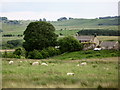
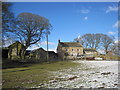
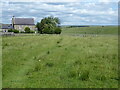
The Ash
by Oliver Dixon
Farm on the road from Wark to Stonehaugh.
|
|
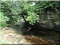
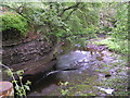
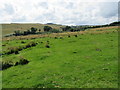
Warks Burn
by T Eyre
Pennine Way bridge crossing Warks Burn.
|
|
The Pennine Way near Horneystead
by Dave Kelly
|
|
The Ash
by Les Hull
|
|
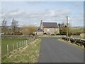
Leadgate
by Oliver Dixon
Cottage near Broughy's Hill. On the Pennine Cycleway.
|
|
Warks Burn
by Dave Dunford
From the Pennine Way.
|
|
Horneystead farm.
Beside the Pennine way.
|
|
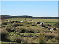
Jenny's Crags
by Mike Quinn
|
|
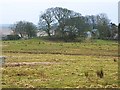
Near Horneystead
by T Eyre
Looking SW.
|
|
The Pennine Way near Leadgate
by Dave Kelly
|
Explore more images in this square: | View Filtering options | View all 22 images page by page >>> |
|