Grid reference NY8077
near to Stonehaugh, Northumberland, England
Coverage
We have
20 images
in grid square NY8077
Contribute
Explore gridsquare NY8077
Surrounding area
Maps
 Map © Crown Copyright")
TIP: Click the map for more Large scale mapping
Tip: Click the map to open the coverage map
Sample images
Breakdown list
A sample of 12 photos from 20
for NY8077
- View this square in the Browser >>>
|
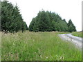
Forest track and footpath near Craigshield
by Mike Quinn
|
|
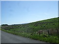
Sustrans Route 68 near Craigshield |
|
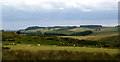
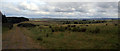
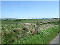
Northumberland landscape
by Oliver Dixon
Looking out over the valley of the Blackaburn.
|
|
Warks Burn
View looking across Warks Burn near Craigshield.
|
|
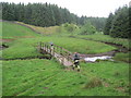
Footbridge over Blacka Burn
by Les Hull
|
|
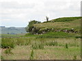
Horneystead Crags
by Mike Quinn
|
|
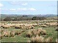
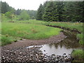
Blacka Burn
View looking across Blacka Burn at the edge of Wark Forest.
|
|
Bridleway towards Blacka Burn
by Les Hull
|
|
Sustrans Route 68 near Craigshield |
|
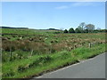
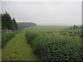
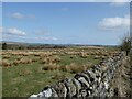
Rough grazing
by Oliver Dixon
By the road from Stonehaugh to Wark.
|
|
Sustrans Route 68 near Craigshield |
|
Blacka Burn
by Les Hull
|
Explore more images in this square: | View Filtering options | View all 20 images page by page >>> |
|