Grid reference NY6889
4 km WNW of Falstone, Northumberland, England
Coverage
We have
28 images
in grid square NY6889
Contribute
Explore gridsquare NY6889
Surrounding area
Maps
 Map © Crown Copyright")
TIP: Click the map for more Large scale mapping
Tip: Click the map to open the coverage map
Sample images
Breakdown list
images taken from NY6889 [1]
A sample of 12 photos from 28
for NY6889
- View this square in the Browser >>>
|
Site of the Miner's Institute, Plashetts
by Les Hull
The Miner's Institute isn't mentioned in the article published in 1873 and it isn't marked on the 1897 OS Map. I was told that The Institute was never used because after it was constructed the mine closed. the Institute was... (more)
|
|
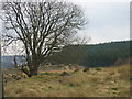
Pond in Kielder Forest |
|
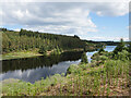
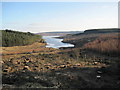
Belling Burn inlet of Kielder Water
A view of this quiet inlet near the mouth of the Belling Burn, as viewed from the Lakeside Way.
This photograph was taken during the Coronavirus (COVID-19) pandemic of 2020/21.
|
|
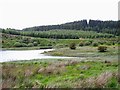
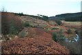
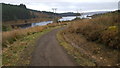
Mouth of the Belling Burn
by Oliver Dixon
The Belling Burn enters Kielder Water in a long broad inlet. The Line of the newly opened Lakeside Way can just be seen.
|
|
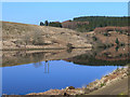
Reflections in Kielder Water
by Oliver Dixon
Kielder Water is the largest artificial lake in the United Kingdom by capacity and it is surrounded by Kielder Forest, the largest man-made woodland in Europe. It was constructed in 1974-1981 to satisfy the demands for water by the heavy... (more)
|
|
Lakeside Way
by Anne Burgess
The path here ascends the slope of Whinny Hill, from where this view is taken.
|
|
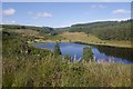
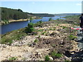
Belling Burn Arm, Kielder Water
by Richard Webb
The flooded Belling Burn forms a big inlet on the northern shore of Kielder Water.
|
|
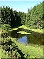
Soney Gap
Large pond at Soney Gap in Kielder Forest. Black Belling is visible in the background.
|
|
Belling Burn Inlet, Kielder Reservoir
by Les Hull
|
|
Lakeside Way cycle track |
|
Lakeside Way - Kielder Water
The Lakeside Way was recently completed (2009) and is a full perimeter walking and cycling route hugging the lakeside of the UK's largest body of water. (42 Km).
|
|
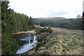
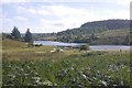
Flooded Belling Burn
by Richard Webb
An arm of Kielder Water.
|
Explore more images in this square: | View Filtering options | View all 28 images page by page >>> |
|