Grid reference NY2415
near to Rosthwaite, Cumbria, England
Coverage
We have
96 images
in grid square NY2415
Contribute
Explore gridsquare NY2415
Surrounding area
Maps
 Map © Crown Copyright")
TIP: Click the map for more Large scale mapping
Tip: Click the map to open the coverage map
A sample of 12 photos from 96
for NY2415
- View this square in the Browser >>>
|
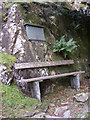
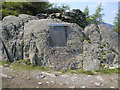
Memorial seat at the foot of Castle Crag, Borrowdale
This is by the footpath leading up from the bridleway on the western side of the crag. The inscription reads: 'The land surrounding the summit of Castle Crag was given to the Nation in memory of Sir William Hamer MA MD FRCF by his... (more)
|
|
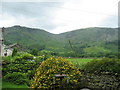
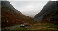
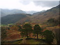
Tongue Gill
by Steve Carter
Looking up Tongue gill from Rosthwaite, with High Spy to the right.
|
|
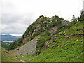
Castle Crag
Looking north towards Derwent Water. The crag is in the NE corner of the grid
|
|
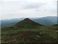
Cairned top
by David Brown
Unnamed and smaller than it looks from a distance.
|
|
Slate wall on Castle Crag |
|
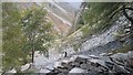
Castle Crag
by Digby Maass
Looking down at the path towards Honister from the small disused quarry near the top of the crag
|
|
Misty day by Broadslack Gill
by Gordon Brown
Castle Crag is up on the right.
|
|
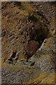
Old level (set of 2 images)
by Ian Capper
One of two old levels on the slopes of Low Scawdel, visible from Castle Crag.
|
|
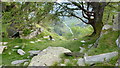
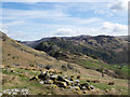
Rock pile on hill slope
The number of boulders gathered together on the slope suggests a small scale 'field clearance', though the ground is hardly premium farmland, being classified as access land. Castle Crag, Grange Fell and Bleaberry Fell all lie in... (more)
|
|
On Castle Crag
Looking towards Seathwaite
|
|
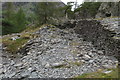
On Castle Crag
Steep scree slopes on the western face of Castle Crag.
|
|
Castle Crag Summit
Castle Crag Summit with cairn above rock mounted war memorial
|
Explore more images in this square: | View Filtering options | View all 96 images page by page >>> |
|