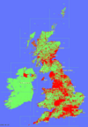
Copyright 2007-2008 Geograph Project Ltd. and released under this Creative Commons Licence: http://creativecommons.org/licenses/by-sa/2.5/ The individual photos that are used to build this dataset are Copyright the respective Licensors, see the full list of contributors here: http://www.geograph.org.uk/credits/
Coverage Maps![]() Coverage Tiles Animation GIF : 1.7Mb Discussion Thread Coverage Now (live) |
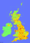
Depth Maps![]() Depth Tiles Animation GIF : 1.2Mb Discussion Thread Coverage Now (live) |
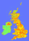
"Recent" Maps![]() Currency Tiles Interactive Viewer Discussion Thread Coverage Now (live) |
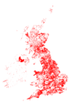
By Year Taken![]() Interactive Viewer Transparent Tiles Discussion Thread |
QuikGrid![]() Experiments Discussion Thread |
Others · Experiments with styles of Depth Maps (Thread) · Visualizing depth of Groups (Thread) · Visualizing locations of Searches run (Thread) also Thread about 2008 specific animations |
The 'thread' links are to the original discussion forum thread that discussed the particular map set. Please provide feedback in the relevent thread! |